Executive summary
As Senior Frontend Developer on Farmlink, I architected reusable Angular components integrated with a .NET API, Mapbox GL, and Google Analytics — boosting real-time agricultural insight accuracy by 33% for enterprise clients and accelerating delivery cycles by 30%.
The problem
- Enterprise agricultural clients needed accurate, real-time geospatial insights.
- The frontend had to stay fast and maintainable as features grew.
- Mapping and analytics had to integrate cleanly with a .NET backend.
The solution
- Architected reusable Angular components for a scalable, maintainable frontend.
- Integrated a .NET API for real-time agricultural data.
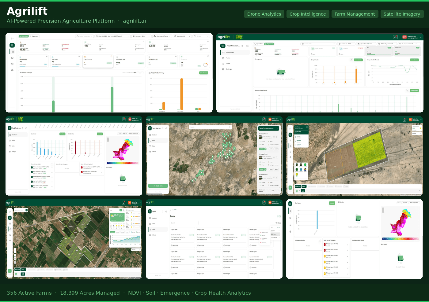
- Built interactive Mapbox GL visualizations for geospatial insights.
- Wired Google Analytics for usage and engagement measurement.
Technical architecture
How the system fits together - each layer reflects technology used on the real build.
Presentation
Reusable, responsive UI
Mapping
Geospatial visualization
Data & APIs
Real-time agricultural data
Analytics
Usage & engagement insight
Engineering challenges
Accurate real-time insights
Surfacing trustworthy, real-time agricultural data improved insight accuracy by 33% for enterprise clients.
Maintainable component architecture
Reusable Angular components accelerated delivery cycles by 30% while keeping the codebase clean.
Geospatial performance
Integrating Mapbox GL with live data required careful rendering and state management.
Performance & SEO outcomes
Real-time agricultural insights for enterprise clients.
Through reusable Angular components.
Interactive geospatial visualizations.
Usage & engagement instrumentation.